Hiking in Nerja is one of the most prominent tourist activities on the Costa del Sol, offering some of the best routes in the region. The Natural Park of Sierra Tejeda, Almijara, and Alhama, located in the mountains near Nerja, is an ideal place for hiking, with breathtaking views of the coast and mountains.
With its mild climate, Nerja is a perfect destination for those who want to enjoy nature year-round. You can easily reach the starting point of some of the most well-known hiking routes in the area by hiring an automatic car in Malaga.
Table of Contents
Top Hiking Routes in Nerja
Between the sea and the mountains, hiking in Nerja offers incredible places to explore. In this post, we have selected the best routes near the area and categorized them according to their difficulty.
Easy Hiking Routes in Nerja
For visitors who want to enjoy a simple hike and connect with nature in the Axarquia region, there are several family-friendly routes that can be completed in a short time with low difficulty.
Nerja Cave Trail
For travelers looking for an easy hiking route in Nerja with the best views, the Nerja Cave Trail is one of the best options. It is suitable for children or people with different physical conditions.
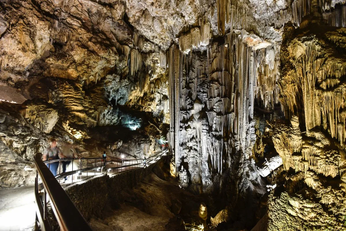
The trail is well-marked and offers an impressive panoramic view of the Sierra de Tejeda and the coast, passing by the popular caves of Nerja at a relaxed pace. We recommend ending the hike by enjoying some tapas in Nerja.
Important Information
- Estimated Time: 1h
- Distance: 2.1km
- Elevation: 139m
- Estimated Location: Natural Site of Maro-Cerro Gordo Cliff
Mirador Cantarriján – Cerro La Caleta Route
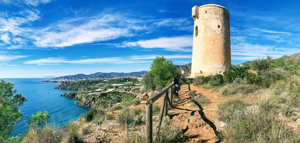
For those who want to keep the coast in sight, the Mirador Cantarriján – Cerro La Caleta route, passing through Cañuelo Beach, is one of the most beautiful and easy routes in Nerja. The route starts at Mirador Cantarriján and gently descends to Nerja’s beach of the same name.
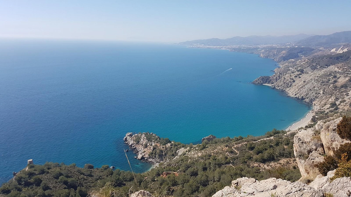
Then, it ascends towards Cerro La Caleta, offering breathtaking views of the coast and the sea. During the hike, you can see remnants of ancient buildings and ruins of watchtowers. The summit of Cerro La Caleta is the highlight of the hike, providing panoramic views of the sea and the mountains.
Important Information
- Estimated Time: 2h
- Distance: 5km
- Elevation: 259m
- Estimated Location: Natural Site of Maro-Cerro Gordo Cliff
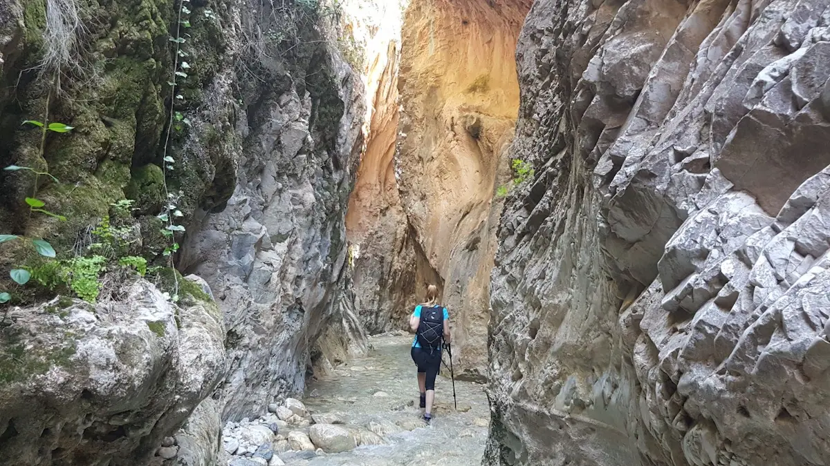
Río Chíllar Route
One of the most well-known hiking routes in Nerja is the Río Chíllar Route, also known as Los Cahorros. This trail is located in the Natural Site of Maro-Cerro Gordo Cliff. It starts at the A-7 highway bridge in Nerja, where parking is available.
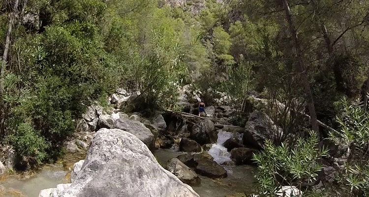
The route follows the course of the Río Chíllar, known for its crystal-clear waters and natural beauty. As you progress, the landscape changes, and you encounter a mix of streams, waterfalls, and fresh water pools.
This route is not very challenging, although there are some sections where you need to climb small rocks and cross narrower parts of the river.
During the summer season, part of the route can be done along the riverbed, so it is advisable to bring swimwear, non-slip footwear, and a change of clothes.
Important Information
- Estimated Time: 4h
- Distance: 8km
- Elevation: 118m
- Estimated Location: Natural Site of Maro-Cerro Gordo Cliff
Medium-High Difficulty Hiking Routes in Nerja
For hikers looking for longer routes ranging from 11 to 20km, where they can enjoy some of the most beautiful villages in the Nerja mountains, which will undoubtedly surprise them with their picturesque streets, friendly locals, and unique gastronomy.
Maro-Cerro Gordo Cliffs Route
The route starts at the Maro-Cerro Gordo Natural Area and runs between the provinces of Malaga and Granada. From the starting point, you follow a well-signposted trail that winds along the coast, offering incredible views of the sea.
During the journey, you pass through coves and beaches with clean and clear waters, such as Cala del Cañuelo and Maro Beach. These places are perfect for taking a break and enjoying a refreshing swim in the sea.
The route ends at the Cerro Gordo viewpoint, which provides an impressive panoramic view of the entire coast and the surroundings of Nerja, an ideal place to rest, take photos, and enjoy the natural environment.
Useful Information
- Estimated Time: 3h 30min
- Kilometers: 12.8km
- Elevation: 548m
- Estimated Location: Maro-Cerro Gordo Cliffs Natural Area
Pico del Cielo Route
The Pico del Cielo route is one of the most interesting challenges for hiking in Nerja. Starting from the Nerja Caves, the trail leads to the highest peak in the area, reaching 1,508 meters in altitude.
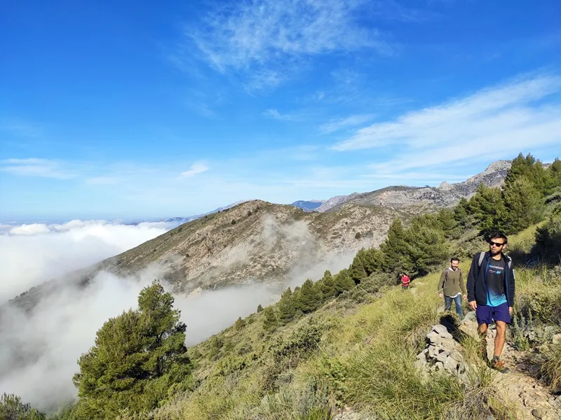
Although the trail is relatively easy, the elevation gain is significant. However, any person with average fitness will forget about the effort while enjoying the landscape of the Natural Park of Sierra Tejeda, Almijara, and Alhama. At the summit, hikers will enjoy incredible views of the area.
Important Information
- Estimated Time: 8h
- Distance: 12km
- Elevation: 652m
- Estimated Location: Natural Park of Sierra Tejeda, Almijara, and Alhama
Fuente del Esparto – Pico Almendrón Route
The Sierra de Almijara trail is a hidden gem for hiking in Nerja, ideal for those looking for a lesser-known route. The trail passes through the Cazadores and la Higuera ravines before reaching the spectacular natural viewpoint of La Puerta, which stands at over 1,200 meters above sea level, offering breathtaking views.
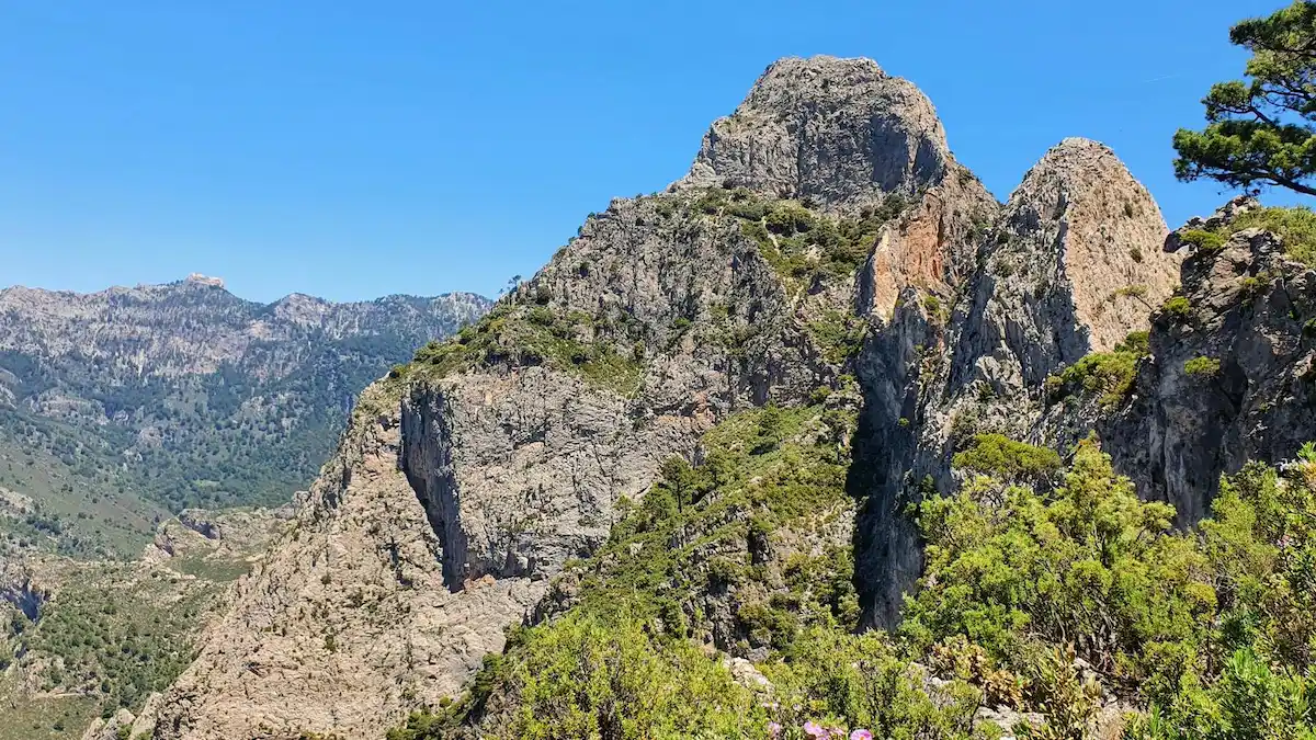
Continuing north, the trail enters the Tajo del Almendrón, a majestic cliff overlooking the Chillar Valley, providing a unique panoramic view. This route is an ideal option for those who want to explore a peaceful area and enjoy the natural beauty of the surroundings.
Important Information
- Estimated Time: 5h 50min
- Distance: 12.7km
- Elevation: 1012m
- Estimated Location: Natural Park of Sierra Tejeda, Almijara, and Alhama
Hiking Routes Map in Nerja
Although these are some of the best hiking routes near Nerja, this area of Axarquia has numerous routes for all levels and preferences, whether along the coast or through its lush mountains. In the following map, you can find the starting points of the mentioned routes.