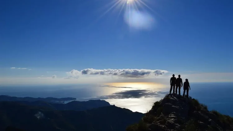

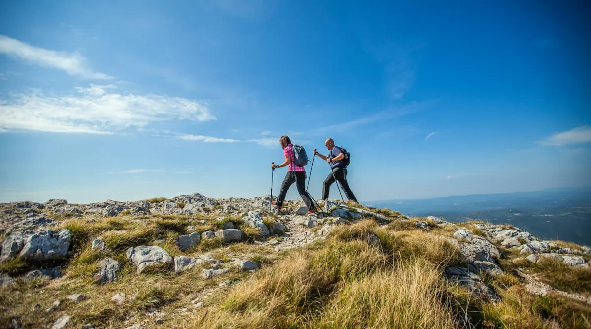
For those looking for the best hiking routes on the Costa del Sol, this region in southern Spain undoubtedly has a lot to offer. With stunning landscapes that combine sea and mountains and a warm climate perfect for exploring its natural surroundings at any time of the year, this is undoubtedly the perfect destination for hiking.
Those who want to enjoy its variety of routes and unique nature can find automatic car rental at Malaga Airport, located halfway between the different locations mentioned in this post.
Table of Contents
Main Hiking Areas on the Costa del Sol
Among the best hiking areas on the Costa del Sol are mainly those near the coast, offering spectacular views with the sea in the background from the top of any of its viewpoints and sierras.
Marbella
The city of luxury, excess, and exclusive parties also has some of the most stunning hiking routes on the Costa del Sol for hikers, starting from the seaside and reaching the highest peak from which you can find breathtaking views of Marbella and its coast.
Monte Elviria Route
Starting the route from the town of Ojén, a winding dirt path ascends the slopes of Sierra Blanca, offering an easy terrain that makes it a perfect choice for trail and cycling enthusiasts.
The itinerary culminates at the summit of Monte Elviria, where you can enjoy an impressive panoramic view of the coast and the characteristic vegetation of this area, dominated by cork oaks and holm oaks.
Points of Interest
- Estimated Time: 2h 30min
- Kilometers: 7km
- Elevation: 432m
- Estimated Location: Sierra Blanca – Ojén
- Difficulty: Moderate
Three Valleys Route
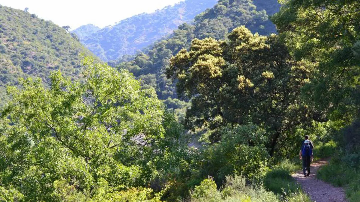
This route begins in the town of Istán and is characterized, as its name suggests, by crossing the valleys of El Molino, El Peñoncillo, and Valle de las Cañas. The Three Valleys is a long route for those seeking a physical challenge, rewarding adventurers with stunning views of its valleys and mountains.
Points of Interest
- Estimated Time: 8h 40min
- Kilometers: 16km
- Elevation: 800m
- Estimated Location: Sierra Blanca – Istán
- Difficulty: High
Estepona
The natural environment of Estepona is perhaps one of the least explored but also one that offers some of the most intriguing routes, with charming villages and wonderful views of the sea and mountains from the heights.
Pinsapos Walk Route
The Pinsapos Walk route is known for its low difficulty and natural beauty, making it an ideal itinerary to enjoy with family and friends. It passes through a forest of pinsapos in Sierra Bermeja, one of the native trees of the area.
The trail is easy and suitable for all hiking levels, crossing a bridge over the Algarrobo River gorge to culminate in a square with a beautiful mural featuring the poetry of Federico García Lorca.
Points of Interest
- Estimated Time: 1h
- Kilometers: 1.5km
- Elevation: 185m
- Estimated Location: Sierra Bermeja
- Difficulty: Easy
Genalguacil – Jubrique Route
One of the lesser-known and most beautiful hiking routes on the Costa del Sol connects two charming white villages in Estepona. With moderate elevations, it offers breathtaking views of the Genal Valley and boasts a diverse flora and fauna.
The trails on this route are well-marked, passing through streams where you can rest. The route ends in Jubrique, where hikers can enjoy a delicious meal before returning.
Points of Interest
- Estimated Time: 3h 36min
- Kilometers: 11.99km
- Elevation: 675m
- Estimated Location: Genal Valley
- Difficulty: Medium-High
Málaga
The capital of the Costa del Sol offers diverse hiking routes, from those that start in the heart of the city and provide a beautiful view of Málaga to those that traverse the Natural Park of the Montes de Málaga in the midst of nature.
Gibralfaro Hill Route
For those who want an easy hiking route without giving up the beauty of Málaga’s monuments, this city offers a route that runs from Mundo Nuevo Street through an urban path where you can enjoy the transition between the city and nature.
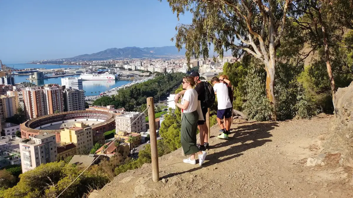
With a simple ascent, though with a steep elevation gain, this route is short and ideal for families, leaving incredible views of the city at its summit. Additionally, visitors can enter the famous Gibralfaro Castle.
In this route, you will find one of the most famous viewpoints in Málaga where you can take the most characteristic photo of the city with the port, the cathedral, and the bullring.
Points of Interest
- Estimated Time: 1h
- Kilometers: 3.4km
- Elevation: 128m
- Estimated Location: Gibralfaro Hill
- Difficulty: Easy
Montes de Málaga Route – Pocopán Viewpoint
The surroundings of the Montes de Málaga Natural Park are rich in vegetation and ideal for those looking to enjoy a hiking route on the Costa del Sol with friends, with plenty of traditional eateries serving delicious local cuisine.
A popular circular route leads to the Pocopán viewpoint, which is accessible for all ages. It starts at Fuente de la Reina, follows dirt trails, and culminates at the viewpoint with beautiful vistas.
Key Information
- Estimated Time: 2 hours
- Kilometers: 5.5 km
- Elevation Gain: 205 meters
- Approximate Location: Montes de Málaga Natural Park
- Difficulty: Moderate
Nerja
Nerja is possibly one of the most beautiful towns in the La Axarquía region and offers charming hiking routes along the Costa del Sol coastline that should not be missed.
Cantarriján Viewpoint – Cerro La Caleta Route
The Cantarriján Viewpoint route to Cerro La Caleta is a beautiful and easy option for those looking to enjoy coastal views in Nerja. Starting at the Cantarriján Viewpoint, the trail gently descends to the beach of the same name.
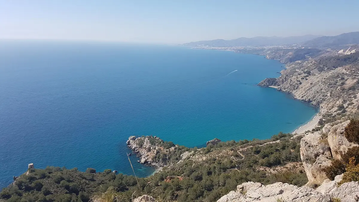
Next, it begins an ascent towards Cerro La Caleta, from where you can enjoy stunning sea views. During the hike, you’ll come across ruins of ancient buildings and watchtowers.
Key Information
- Estimated Time: 2 hours
- Kilometers: 5 km
- Elevation Gain: 259 meters
- Approximate Location: Maro-Cerro Gordo Cliffs Natural Area
- Difficulty: Easy
Pico del Cielo Route
The Pico del Cielo route in Nerja is a challenging hiking trail that starts from the Nerja Caves and leads to the highest peak in the area, at 1508 meters above sea level. Although the elevation gain is significant, the landscape of the Natural Park compensates for the effort. At the summit, hikers can enjoy breathtaking views.
Key Information
- Estimated Time: 8 hours
- Kilometers: 12 km
- Elevation Gain: 652 meters
- Approximate Location: Tejeda, Almijara, and Alhama Sierras Natural Park
- Difficulty: Medium-High
Frigiliana
Continuing in the La Axarquía region, Frigiliana is located further inland, near the coastal town of Nerja. In its surroundings, hikers will find incredible routes where the river and the mountains take center stage, often with the sea in the background at higher elevations.
Cruz del Félix Route
This hiking route on the Costa del Sol begins by descending towards the Higuerón River and then progresses towards the Batán well, an ancient Arab construction used for irrigation of crops.
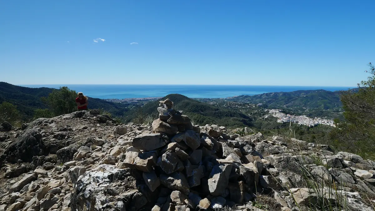
Next, hikers head towards the hills of the Chillar River, reaching the highest point of the route, Cruz del Félix, with impressive panoramic views of the Sierra de Almijara Natural Park, Frigiliana, Nerja, and the coast.
Key Information
- Estimated Time: 2 hours and 30 minutes
- Kilometers: 4.1 km
- Elevation Gain: 256 meters
- Approximate Location: Northeastern Frigiliana Area
- Difficulty: Easy
Acebuchal Route
This is possibly one of the best-viewed routes in Frigiliana. It starts in the Plaza de Ingenio and continues along Carlos Cano Avenue towards Torrox for 3 kilometers, then takes a detour towards Acebuchal and Pedregal on a concrete path.
Upon reaching the Los Cuatro Caminos junction, the route turns right to enter the Natural Park on a dirt trail. Along the way, hikers can enjoy the hamlet of Acebuchal, a village reconstructed in 1998.
Key Information
- Estimated Time: 4 hours and 20 minutes
- Kilometers: 13 km
- Elevation Gain: 417 meters
- Approximate Location: Southern Frigiliana Area
- Difficulty: High
Other Hiking Areas on the Costa del Sol
Although the Costa del Sol offers interesting hiking routes, the inland towns of the province also have a lot to offer to hikers and trail runners, with trails for all levels amidst their most iconic mountains.
Ronda
Without a doubt, Ronda is one of the most beautiful towns in the interior of Málaga. Its routes span from the river to the mountains, offering spectacular views of the Tajo City.
Cañadas de Ronda Route
Considered as one of the top ten hiking routes in Spain, the Cañadas de Ronda route is a 9 km circular route that traverses the Sierra de las Nieves Natural Park. This route is well-marked and features beautiful vistas.
The starting point is at the Quejigales recreational area, and it goes up the Cañada del Cuerno to Puerto del Oso, then descends through the Cañada de las Ánimas, a quaternary pinsapo forest, one of the best-preserved in the world.
This route is recommended in spring or autumn, as winter may have snowy areas that can make the hike more challenging.
Key Information
- Estimated Time: 4 hours
- Kilometers: 9 km
- Elevation Gain: 460 meters
- Approximate Location: Sierra de las Nieves Natural Park
- Difficulty: Moderate
Molinos del Tajo de Ronda Route
One of the main attractions of Ronda is the Tajo Gorge, which this Costa del Sol hiking route follows. With an easy course, the Molinos route is perfect for family outings and capturing the best photos.
Starting at Plaza de España, this route goes through part of the historic center, descending the Cachondeo slope to reach the medieval walls with incredible views of the Puente Nuevo. It then continues along a path with old flour mills, passing through the Hoya del Tajo and ending at the Doctor Vázquez neighborhood viewpoint.
Key Information
- Estimated Time: 2 hours
- Kilometers: 5 km
- Elevation Gain: 180 meters
- Approximate Location: Hoya del Tajo Area
- Difficulty: Easy
Antequera
The Torcal of Antequera is a natural gem in Málaga that must be visited at least once in a lifetime. Explore it on an excursion along one of the hiking routes in this area and be amazed by its natural formations.
Amarilla Route of the Torcal de Antequera
This circular route surprises hikers with its landscape dominated by eroded limestone rocks, with fascinating shapes caused by erosion. The trail is well-marked and passes by various viewpoints and an astronomical observatory.
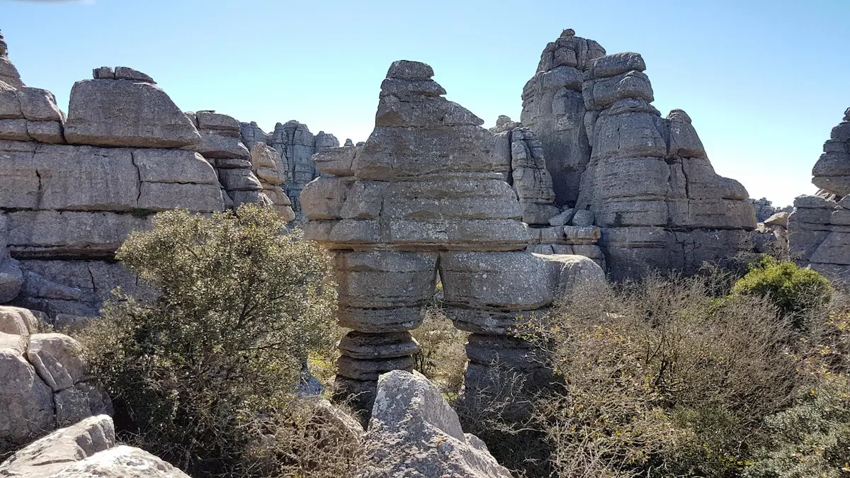
The trail starts at the Torcal Visitors Center parking lot, and along the way, you can enjoy beautiful views and even spot some wildlife such as royal owls, mountain goats, or even deer.
Key Information
- Estimated Time: 1 hour and 20 minutes
- Kilometers: 2.9 km
- Elevation Gain: 65 meters
- Approximate Location: Torcal de Antequera
- Difficulty: Moderate
Peña Negra Route
For the more adventurous, the Peña Negra route is a short but demanding hike that requires good physical fitness due to its steep elevation gain and a section without a trail where you have to climb to reach the summit, but the reward is incredible views of the coast and the mountains.
Peña Negra, near Villanueva de Cauche, marks the entrance to the Guadalmedina Valley. The ascent is challenging, with difficult sections suitable only for experienced hikers. During the climb, you’ll pass through a field of wild olive trees, oaks, and centuries-old trees.
Key Information
- Estimated Time: 4 hours 10 minutes
- Kilometers: 5.5 km
- Elevation Gain: 923 meters
- Approximate Location: Guadalmedina Valley
- Difficulty: High
Fuengirola
Closer to the coast, the Sierra de Mijas offers interesting hiking trails in Fuengirola, although there are also extensive routes along the coast to explore this city on the Costa del Sol.
Altos del Chaparral Route
A route that follows a simple dirt track, very comfortable for hiking or biking. The itinerary starts at the Fuengirola Fire Department and goes up to Altos del Chaparral, passing by the Fuengirola Racecourse. The Altos del Chaparral route is straightforward, although it covers a long distance, making it ideal for disconnecting in nature.
Key Information
- Estimated Time: 2 hours 52 minutes
- Kilometers: 13.16 km
- Elevation Gain: 272 meters
- Approximate Location: Altos del Chaparral
- Difficulty: Moderate
Torremolinos
Although Torremolinos is known for its beach tourism and nightlife, this town also offers a rich natural environment for enjoying some of the best hiking trails on the Costa del Sol.
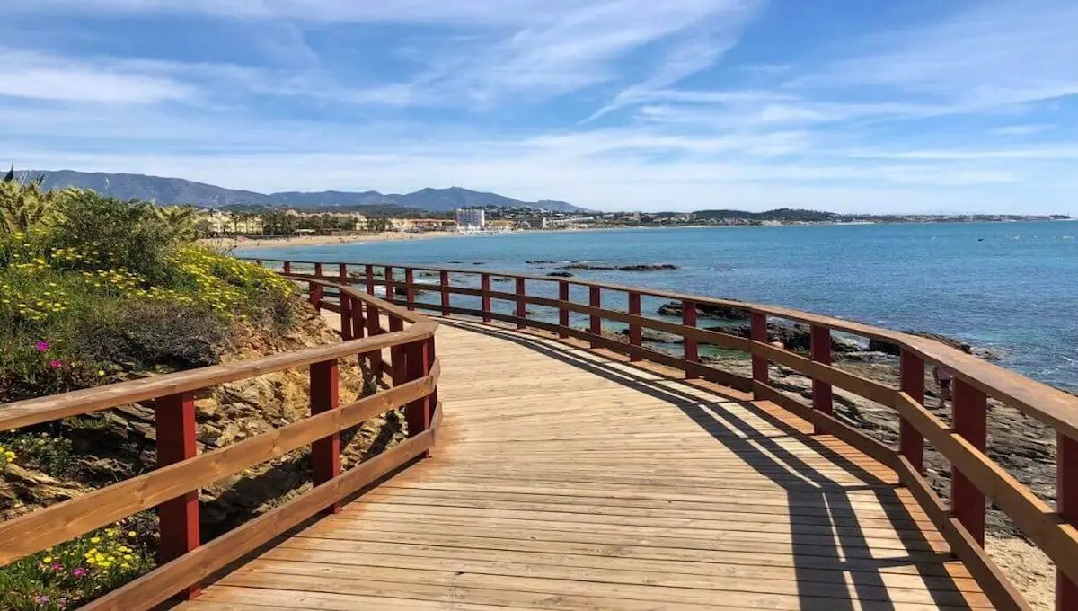
Litoral Trail – Stage 6
The Litoral Trail is a trail of over 300 km that runs along the Costa del Sol by the sea. Stage 6 passes through Torremolinos, providing walkers with an easy route that follows the coast and allows them to enjoy a pleasant walk along the Mediterranean, soaking up the sun and sea breeze. This route is perfect for families.
Key Information
- Estimated Time: 2 hours
- Kilometers: 6 km
- Elevation Gain: None
- Approximate Location: Torremolinos Coast
- Difficulty: Moderate
Gran Senda – Stage 34
Within the framework of the Gran Senda de Málaga, a route consisting of 35 stages that covers the entire province, passing through each of its regions, Stage 34 corresponds to Torremolinos. The route starts in Benalmádena Pueblo and ends in Alhaurín.
During this stage, hikers will enjoy nature as they traverse the municipalities of Torremolinos, Benalmádena, and Alhaurín de la Torre on a convenient network of trails that can be easily covered on foot or by bicycle, enjoying the vegetation and wildlife.
Key Information
- Estimated Time: 4 hours
- Kilometers: 12.3 km
- Elevation Gain: None
- Approximate Location: Sierras de Torremolinos, Benalmádena, and Alhaurín de la Torre
- Difficulty: Moderate
Hiking Route Map in the Costa del Sol
The Costa del Sol can be explored on foot from the seashore to the highest mountains to get the best views of its natural surroundings. Don’t miss any of the routes it offers, which are indicated on the following map.