Sea and mountain collide in a unique setting for hiking in Malaga. The capital of Malaga and its surroundings boast a unique natural environment where lovers of sport and nature will be able to enjoy the best landscapes while travelling through its best-kept secrets under a mild climate, perfect at almost any time of year.
Hence, Malaga is one of the Andalusian provinces with the most natural parks to walk through, high up in the mountains with the sea below, discovering the unique fauna and being amazed by some of the unexpected landscapes that await.
With options for all levels and audiences, this post features some of the best hiking trails in Malaga and its surroundings to tackle with family or friends, all with a low or moderate level so you can enjoy nature. Hikers will be able to reach the starting point, opting to rent a 7-seater car in Malaga so they can travel as a group to enjoy a unique experience from start to finish.
Table of Contents
Hiking trails in Malaga capital
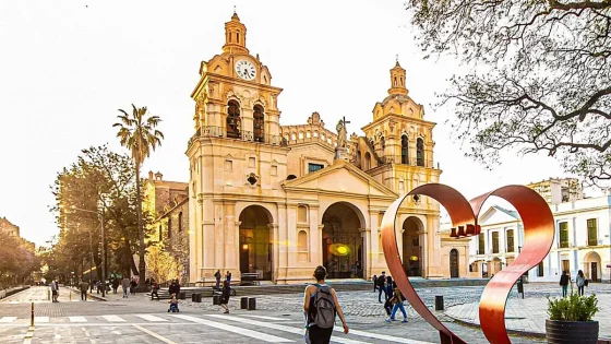
The capital of the Costa del Sol doesn’t just have a beautiful historic quarter and some of the best restaurants in Malaga, it also boasts privileged surroundings in the heart of nature to enjoy the mountains with the sea as a backdrop.
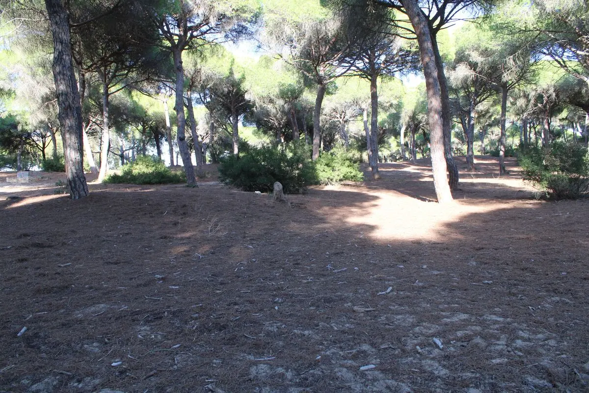
Montes de Málaga mountain range
The Montes de MálagaNatural Park (Parque Natural de los Montes de Málaga) is one of the richest natural spaces and close to the urban centre. Although many locals come to this area in search of its famous ‘ventas’ or roadside eateries, where you can try the most typical local cuisine, like ‘migas’ which is a traditional dish made using old bread and exquisite ingredients, brothy rice (arroz caldoso) or the famous ‘plato de los montes’ which literally means ‘dish from the mountains’, an increasing number of people choose to lose themselves along its hiking trails to enjoy the views offered by this natural park which has been repopulated with more than 5000 pine trees.
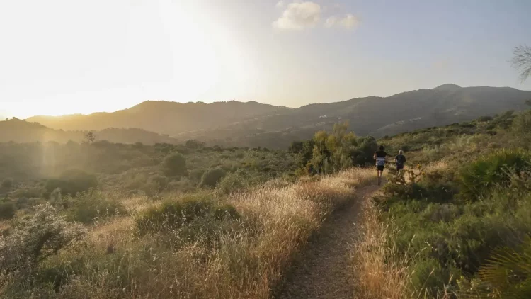
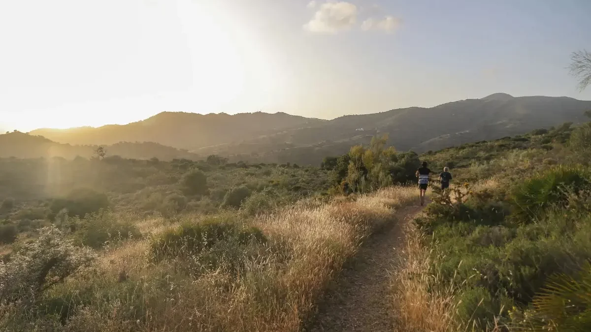
One of the most popular trails in this area is a circular hiking trail to the Pocopán vantage point, with a moderate difficulty where walkers will find dirt tracks that are accessible to everyone, of all ages and fitness levels. To start the trail, hikers should arrive via the A-700 road to what is known as ‘Fuente de la Reina’, where they will find a car park to leave their car and continue along a path that culminates in a short but demanding hill that leads to the aforementioned vantage point, with some spectacular views. The trail has an approximate distance of 5.5 kilometres.
Pinares de San Antón
The surroundings of the Montes de Málaga Natural Park are also home to what is known as the trail of Pinares de San Antón, a simpler option that takes you through mount San Antón, situated near to the neighbourhood of El Palo. For this trail, which has a distance of around 3.9 kilometres, participants should park their car in one of the streets of the well-known neighbourhood of Pinares and reach a vantage point from where they can enjoy an unrivalled view of the bay of Malaga.
From there, the rest of the trail consists of climbing to the top of mount San Antón, following a rocky path until the cross at the summit of this mountain, passing a small cave that offers a new panoramic view. This trail is accessible for the whole family, including dogs, who will enjoy climbing up and down among the rocks of the mountain until they reach the top.
Mount Gibralfaro (Monte de Gibralfaro)
For people wanting to enjoy a special walk without missing out on the views of Malaga’s monuments, one of the trails offered by the city starts in the heart of its historic quarter, offering an image of transition between the city and nature that will amaze hikers. This simple trail takes place along an urban path which starts at Calle Mundo Nuevo and offers a gentle climb with lush vegetation to Mount Gibralfaro (Monte de Gibralfaro), where its monumental castle can be found.
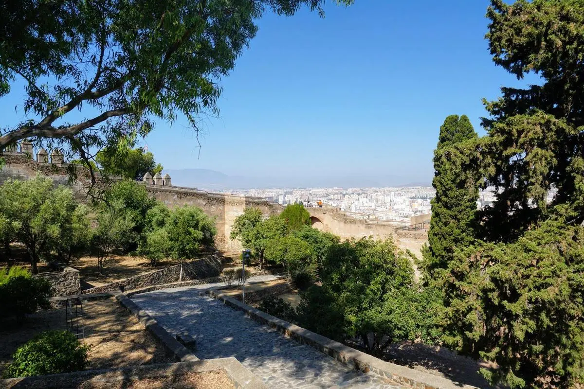
During the walk, hikers will find a children’s play area, where little ones will be able to have some fun while adults enjoy a rest before reaching the summit. From here, they will be able to take one of the most characteristic photos of the city, with the Bull Ring (Plaza de Toros), Muelle Uno and the Paseo del Parque tree-lined avenue as protagonists. An essential trail for those who don’t want to miss out on the charms of the city and don’t want to lose contact with nature, with just a few kilometres to climb.
Hiking trails in east Malaga | CarGest
In the eastern part of the province, the popular region of La Axarquía offers some of the most popular hiking trails in Malaga among visitors and locals, with landscapes that will astound visitors.
El Saltillo Bridge (Puente El Saltillo)
With a medium difficulty and a distance of just four kilometres, the El Saltillo Bridge (Puente El Saltillo) trail tends to amaze hikers. Starting the walk from the town centre of Canillas de Aceituno, a town in the region of La Axarquía which is full of charm. This trail requires a certain physical fitness and is not suitable for people suffering from vertigo, since it takes you next to gorges of a substantial height.
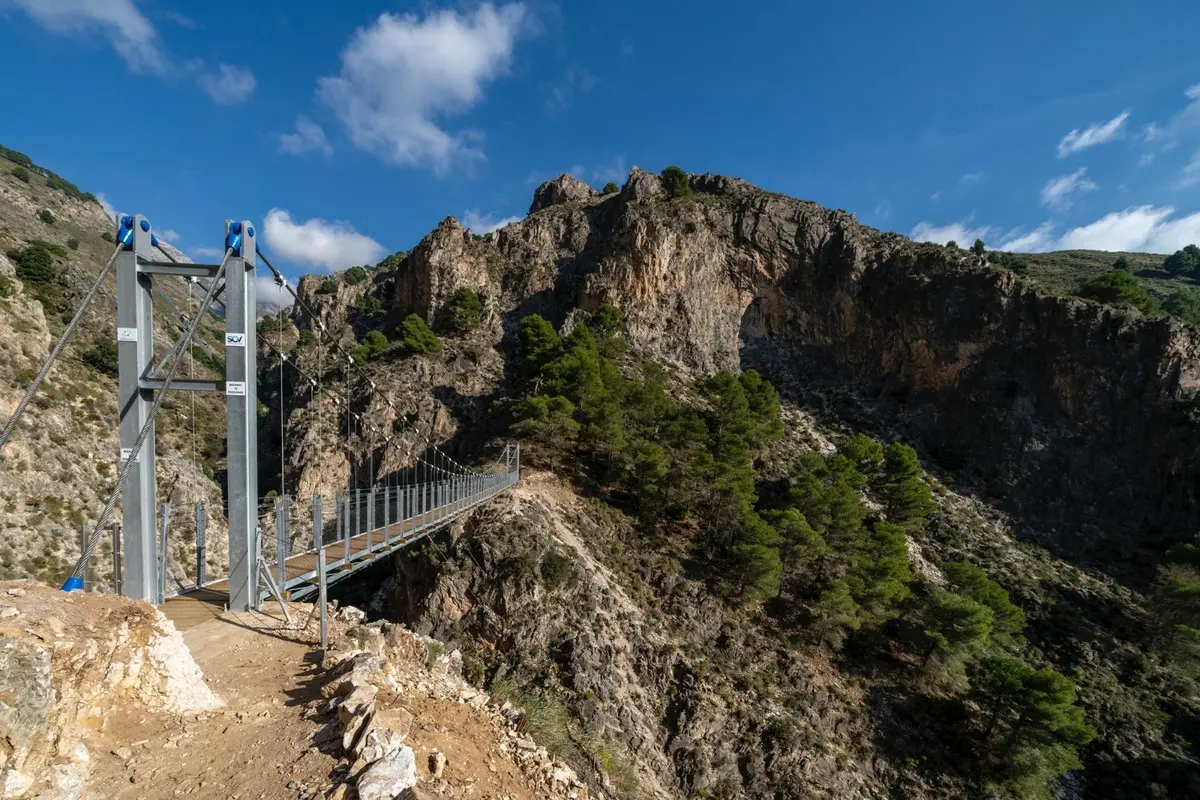
To reach the El Saltillo suspension bridge, hikers should descend a stretch of dirt track with a steep gradient in which they will cross a pine forest to reach this spot, 78 metres above the Almanchares river. Once they have conquered the bridge, walkers will be able to return by retracing their steps or continue the trail to Sedella, another charming white town.
Chíllar River (Río Chíllar)
A special route to do between spring and summer is the Chíllar River (Río Chíllar) trail, in Nerja. Also known as ‘Los Cahorros’ trail, this route takes you along the course of the river itself and, although it has a medium difficulty, it is suitable to do as a family and with pets, in addition to being a truly fun experience for travellers.
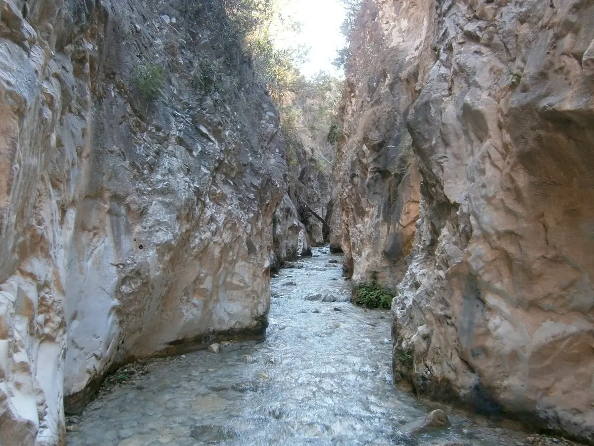
Almost all of the trail flows within the course of the Chíllar River (Río Chíllar), with a depth that will reach walkers’ ankles, so it is a simple trail but walkers should be well-equipped with appropriate waterproof footwear and backpacks made with waterproof material so belongings don’t get damaged. The length of this family trail is around 5km, ending at a pool where you can enjoy a refreshing dip.
However, the bravest hikers will be able to continue the trail for another 3 km until reaching Vado de los Patos, with the route there and back taking approximately 6 or 7 hours, so we recommend starting out early as walking through the water takes longer. On the way back, visiting one of Nerja’s restaurants will be a great idea to recharge your batteries.
Hiking trails in west Malaga
To the west of the capital, you can also enjoy some hiking trails full of charm where you can enjoy contact with nature with unique landscapes and magical villages nestled into the mountains.
Las Cascadas Waterfall Trail (Sendero de las Cascadas)
Sierra de las Nieves National Park is home to one of Malaga’s most highly rated hiking routes thanks to one of the largest waterfalls in the province being hidden within it. Hence, the ‘cascadas’, or waterfall trail unfolds along the river course, starting at the Balneario de Tolox spa, where you will be able to park your car. It has a total distance of
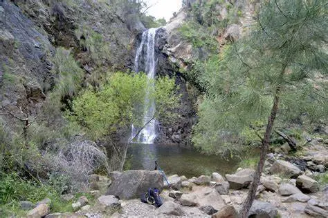
Hikers will start to climb via the road until they reach the trail to the left. After completing the climb along this path, the river course will take them through a route full of pools and ponds where they can enjoy a dip in summer, such as Charco de la Virgen pool and Rejia Waterfall (Cascada de la Rejía). Along the trail, you can find some species that are characteristic of the area, such as mountain goats.
Map of the hiking trails in Malaga
Although these are some of the most popular and simple hiking trails in Malaga, the province offers a rich natural environment where visitors can let themselves be blown away in amazement by the natural paths, with spectacular landscapes and routes adapted to all levels, from beginners who just want to go for a long walk to experts looking for a new physical challenge.